AI and Satellites Monitor Sustainable Rice Cultivation Amid Punjab’s Groundwater Crisis

Researchers are using Sentinel-1 radar satellites and AI to track sustainable rice farming in Punjab, India, where groundwater is rapidly depleting. A UC Berkeley–led team mapped nearly three million plots to monitor Direct Seeded Rice adoption, achieving strong accuracy. The system aids policymakers, though detecting Alternate Wetting and Drying remains challenging.
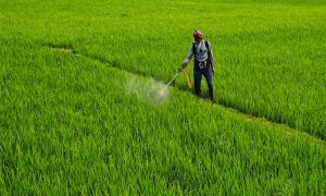
In Punjab, India’s breadbasket, researchers have turned to satellites to measure how quickly farmers are adopting sustainable rice-farming techniques designed to save water in one of the most depleted aquifers on Earth. A joint team from the University of California, Berkeley, The Nature Conservancy, Microsoft’s AI for Good Research Lab, and Yale School of the Environment has pioneered a groundbreaking monitoring system that harnesses Sentinel-1 radar imagery to track farming practices across millions of small plots. Punjab produces more than 10 percent of India’s rice and nearly 3.3 percent of global output, yet groundwater levels are plummeting at 41.6 centimeters annually, threatening both food security and rural livelihoods. Traditional puddled transplanted rice relies on continuous flooding and consumes thousands of liters of water per kilogram of grain. Two sustainable alternatives, Direct Seeded Rice (DSR), which allows seeds to be sown directly without nurseries, and Alternate Wetting and Drying (AWD), which periodically lets fields dry before re-flooding, offer reductions in water use of up to 40 percent. But until now, the true scale of adoption has remained uncertain, frustrating policymakers who need reliable data to design interventions.
Ground Data Meets Artificial Intelligence
To address this gap, the team partnered with The Nature Conservancy’s Promoting Regenerative and No-burn Agriculture (PRANA) program, which trained nearly 150,000 farmers in 2023–24 and documented practices at 1,400 fields. These ground records, covering sowing dates, irrigation schedules, and field boundaries, became the training dataset for a satellite-based classification model. Crucially, the researchers developed a “dimensional framework” that separated water management into two axes: sowing (DSR versus traditional transplanting) and irrigation (AWD versus continuous flooding). This approach avoided the confusion of trying to detect all practices at once and proved far more accurate. By exploiting subtle temporal patterns in the radar signal, the model achieved a 78 percent F1-score in detecting DSR even without knowing when fields were planted, a breakthrough given that planting dates in Punjab can vary by more than 100 days.
Mapping Millions of Fields from Space
Scaling the model across Punjab required identifying nearly three million agricultural plots. The researchers turned to Sentinel-2 imagery and the Fields of the World machine learning algorithm to automatically delineate farm boundaries. With this foundation, they applied their classification system to plot-level radar data, producing a statewide map of adoption patterns. Validation against government records showed strong alignment: the model correlated with official estimates of 253,000 acres under DSR in 2024 with a Pearson coefficient of 0.77. Maps of adoption reveal striking variations both across districts and within them. For instance, while some districts like Fazilka were underestimated, others, such as Sangrur and Bathinda, showed overestimation compared to state data. These discrepancies highlight both the limitations of the model and the possibility that official incentive-based reporting contains inaccuracies, as seen in neighboring Haryana, where nearly 70 percent of subsidy claims were later found to be false. Importantly, the satellite approach preserved the relative ranking of districts, allowing policymakers to identify priority regions even when exact figures remain debated.
Cracks in the Irrigation Picture
While the system proved robust for detecting DSR, tracking AWD adoption was far more difficult. Because irrigation cycles occur every four to ten days, Sentinel-1’s twelve-day revisit schedule missed much of the activity. As a result, models relied heavily on “lag features” such as differences in planting times rather than direct detection of irrigation. This made classification less reliable and raised concerns about generalizing results across multiple seasons. The researchers concluded that only with the launch of Sentinel-1C, which will cut revisit times to six days, will it become possible to capture AWD cycles accurately. Despite this shortcoming, the team emphasized that their framework is well-positioned to integrate such improvements, with the potential to dramatically enhance monitoring of irrigation practices once higher-frequency data becomes available.
A Roadmap for Sustainable Agriculture Monitoring
Beyond its technical achievements, the study carries major policy implications. It shows that governments no longer need to rely solely on patchy surveys to understand how farmers are responding to sustainability programs. Instead, satellites and artificial intelligence can deliver timely, comprehensive insights at the level of individual villages or even fields. This enables more precise targeting of subsidies, evaluation of training programs, and measurement of whether adoption is spreading. The researchers argue that their Punjab framework can be adapted to other rice-growing regions facing water stress, from the Mekong Delta to sub-Saharan Africa. They envision expanding to region-specific models, incorporating advanced deep learning systems like Presto, and building open platforms where policymakers and scientists alike can track progress. As aquifers decline and climate change intensifies, such scalable solutions will be crucial to ensuring food security without exhausting water resources. In Punjab, where shimmering paddy fields mask a crisis below ground, satellites are beginning to tell a different story, one of resilience, adaptation, and the possibility of producing more with less.
To Read more about Rice News continue reading Agriinsite.com
Source : Devdiscourse


